Will I be able to walk Hadrian's Wall? Read on to hear from one of our expert guided walking tour leaders, Helen Fletcher
Step back in time nearly 2000 years. Imagine the pounding feet of Emperor Hadrian’s army. On his orders they were building a wall 6 metres high and 73 miles long just to the north of the even older Stanegate road from Corbridge to Carlisle.
Go back 300 million more years to the setting down of rocks: sediments which formed sandstone and shales in the East, and limestone when the area was covered by a tropical sea. Later the eruption of volcanic rock forming the dolerite of the Whin Sill in the central area and, much nearer our time, the action of glaciers which left boulder clay in the West and the salt marshes of the Solway Firth.
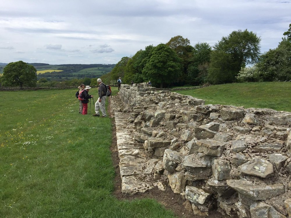
Our present day journey begins a short drive from our hotel in Hexham at Whittle Dean reservoir. Within an hour we catch our first glimpse of the Wall- a few well-cut blocks of stone in a farmer’s field. More sections become evident as we proceed westwards, but there is not much trace of the deep ditch that was dug on the Northern side. To the South, however, the vallum (a double earth wall with a trench 36m wide between) is more obvious in many places along our 66 mile route. Our first day ends at Chesters fort and museum: a chance to learn more of the history and the way of life along the Roman Wall.
Each day we walk 16km (10 miles) or more along the wall, the views changing as the landscape gets wilder in the central area. The wall is now a constant reminder of times past. Nature provides an additional barrier in the Whin Sill, with its steep escarpment to the North, and gives us a roller-coaster experience as we walk along, passing through the iconic Sycamore Gap. We see many milecastles (look-out posts), manned day and night in all weathers and end each day at a fort or museum: Housesteads; Carvoran, or make a slight detour to the great site of Vindolanda. By day 4 the sections of the wall become harder to see. We are now coming to the end of the stone wall and find less evidence where the wall was built of turf in the West. There are well-preserved milecastles still in places.
On day 4 we have left our hotel, opposite the Abbey church in Hexham, and after our walk our bus takes us to our new hotel in Carlisle, the base for the final 2 days of our journey. Now we are walking through arable land, villages and along the River Eden. The last day will bring us to the coast at Bowness-on-Solway. This is a longer distance of 24 km (15 miles), but can be shortened by using the local bus service. Our goal is in sight! All the way along the route we have been able to stamp our ‘passports’ and now the final one is obtained at the King’s Arms, where we can claim a certificate to mark our achievement, and have a celebratory drink!
Here's a few frequent questions we get asked by our customers before booking this holiday:
1) How fit do I need to be?
You should be able to walk 10 miles a day on fairly good paths. It will help if you do walk regularly at home.
2) What is the walking like most days?
Much of the route is gently undulating, though the central section has more climbing (360m in a day). The final day is longer (15 miles), but a local bus can help.
3) Where do we stay?
We use 2 very comfortable Hotels. The first 4 nights in Hexham, opposite the Abbey church; a delightful market town, the last 3 nights in Carlisle; a busy commercial centre, with plenty of shops and two excellent museums.
4) When is the best time to walk the route?
We offer tours from May to October. There are advantages to choosing any of these. The weather cannot be guaranteed, but May is always a great time to walk this route, due to the beautiful spring flowers you'll spot.


.jpg?ni=%2Fimages%2Fno-image.png)
.jpg?ni=%2Fimages%2Fno-image.png)
.jpg?ni=%2Fimages%2Fno-image.png)
.jpg?ni=%2Fimages%2Fno-image.png)
.jpg?ni=%2Fimages%2Fno-image.png)
.jpg?ni=%2Fimages%2Fno-image.png)


